More Proof
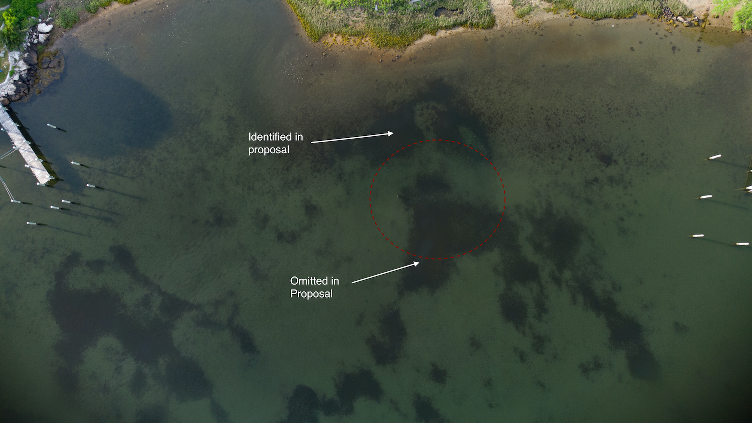
A new high def photo was taken of the proposed dock site. A drone equipped with a polarizing filter took a photo that was processed with a luminance filter to increase the contrast between SAV and sandy bottom. The result is dramatic and shocking. Note that a red circle depicts the area that would be impacted by the dock and the large boats it was designed to berth. This circle covers a large bed of SAV that was not included in the maps submitted by Louriero Engineering for Mr. Naik (See arrow with label "Omitted in Proposal.)
Here is the actual proposal:

Notice there is no mention of Eelgrass or SUV within the red circle. It isn't clear why this large bed of SAV was not addressed. Given the current importance of SAV, a basic part of their planning should have been a careful survey of the proposed location of the dock and boats. It seems implausible that the high powered team assembled by Mr. Naik simply overlooked such a key issue. It is reasonable to conclude that this critical detail was intentionally not included in the proposal since this would have made approval of the plan less likely.
"What is next for Masons Island? Dirt Bike tracks? How about Mud-bog races?" Concerned resident